On April 8th, 1952, a B-25 bomber crashed into Mount Tom, a 9,741 foot peak 10 miles west of Golden, Colorado. The plane crashed at a speed of 200 mph, instantly killing all 11 people inside. Low hanging clouds and dense fog clung to the mountains that day. Search parties from the Lowry Air Force Base, Civil Air Patrol, and Fourth Rescue Squadron searched for two days before spotting the missing bomber after the fog finally cleared.

The bomber was flying a routine route from Leavenworth, Kansas to Denver, Colorado, but according to the Air Force aircraft accident report there was a misinterpretation of radio range signals and a mistake in dead reckoning calculations regarding ground speed, so they flew past the destination of Lowry Air Force Base – located at the time between Denver and Aurora – and crashed into Mt. Tom, 25 miles to the northwest of Denver.

The accident report states that at 10:37am the crew aboard the B-25 erroneously identified their location as 45 miles east of Lowry AFB, but they were actually only 9 miles to the east of Lowry. The last radio contact with the aircraft was at 10:44am when they identified their location as 25 miles east of Lowry. They crashed 3 minutes later. The miscalculation resulted in the aircraft maintaining its approach altitude of 9,000′ upon impact. They likely didn’t see the mountain until they were upon it.
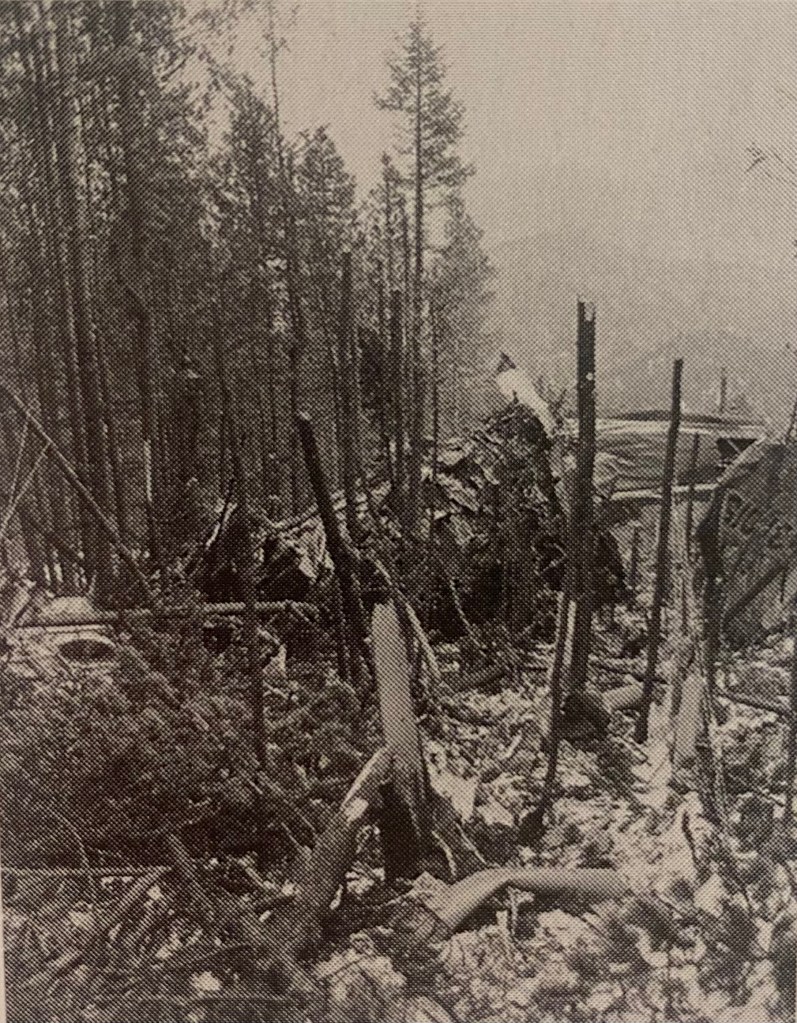
The plane crash left a scar in the mountaintop 30 yards wide and 75 yards long that can still be seen today.
The plane on a routine flight was following Lowry field’s radio beam on instruments from the first point of contact 45 miles east of Denver. It passed over the field and the beam changed direction but the plane continued on and crashed a few minutes later.
The Colorado Transcript, April 17, 1952


Victims of the plane crash:
- Capt. Arthur Burt “Buster” Wilcox, pilot
- Lt. Col. Merrill E Smith, co-pilot
- Maj. William Haughey
- Maj. Eugene Markel
- Cap. Lorence Ellenberg
- Lt. Royce Brasington
- Cap. Franklin Wicks
- Cap. Andrew Celovsky
- John Altgelt, Technical Sergeant
- David Dahl, Airman 2nd Class
- Dr. Donald Vestal, Civilian

On April 10th, two days after the crash and with the fog finally lifted, a local 22 year old rancher named William Koch was the first person on the scene. That morning, while out on his ranch, he spotted a black hole near the top of the peak that didn’t look right. He contacted a few people he knew in Golden and then hiked 3 miles from his home up rugged, rocky, backcountry terrain, sometimes post-holing through deep snow to arrive at the terrible scene. Other rescue groups arrived soon afterwards.
An interview with Koch from Rocky Mountain News dated May 11, 1952 reads, “I was the first to reach the wreckage, I guess. It was the most horrible sight I’ve ever looked upon. I don’t think I’ll ever forget it. I didn’t know what to do. They were all dead. And there was just nothing I could do for them”

Small pieces of the nose of the plane were found at the top of the scar, and larger pieces of the tail were found at the bottom. The remains of the victims will not be recounted here. See John Gregory Country by Charles & Mary Ramstetter or find the original Rocky Mountain News articles for more details.
After recovering the victims’ remains, the Air Force blew up the remaining larger pieces of plane that were still intact so that other planes flying over this area did not mistake the scar as the site of an unreported plane crash. The scraps are strewn along the scar and into the woods to this day.

For a bit more history of the area, Mt. Tom was named after Thomas Golden, a local prospector and the namesake of Golden, CO. Mount Tom has also been called Golden Peak, as well as Lady Bug Peak because the spotted insects like to gather on the mountain in August and September to prepare for hibernation inside the fallen mountainside pines.
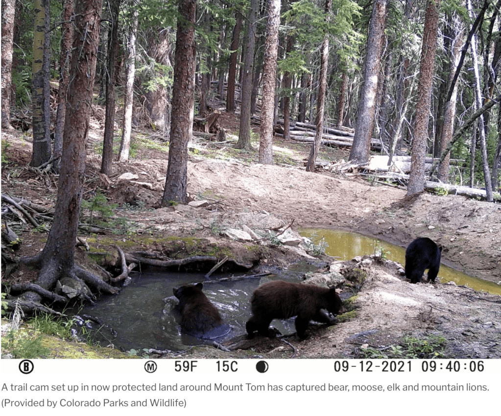
Mt. Tom is most recently the centerpiece of a 2,000 acre protected area, a collaborative effort of modern conservation between Jeffco Open Space, Great Outdoors Colorado, Colorado Parks & Wildlife, The Conservation Fund, and private landowners. Does this mean the B-25 crash site will be accessible to the public sometime in the future? It’s possible. JCOS and CPW will be taking their time studying wildlife habits of the area for the next few seasons before deciding on how to build a trail to the summit.
“It’s one of the largest swaths of open-space preservation on the Front Range since the creation of Jefferson County’s Centennial Cone Park in 2005.”
The Colorado Sun

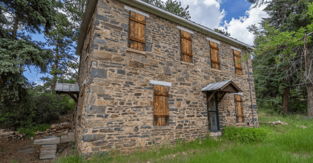
Near the southern end of the Mt. Tom preserve on the Douglas Mountain Study Area property is the Centennial House, so named because it was built in 1876 as a waystation on the Gregory Toll Road now known as Golden Gate Canyon road. Weary travelers and their animals headed to the gold mines of Black Hawk and Central City would stop for food and accommodation at the Centennial House, built in the Italianate-style out of hand laid stone, hand-cut stone quoins, and incised mortar. The JCOS owned property was recently listed on the Colorado Register of Historic Properties, and received a grant from the Colorado State Historical Fund to prepare a Historic Structure Assessment to create a plan for preservation. Hopefully we will be able to visit this site in the future.
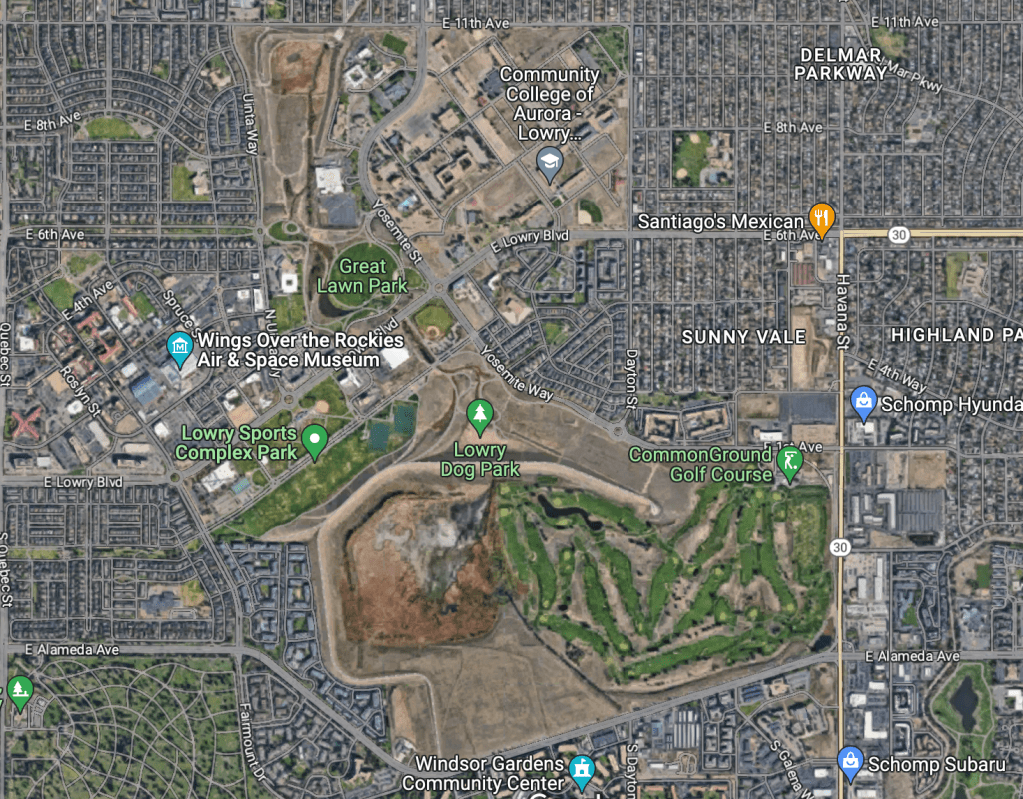
Lowry Air Force Base was named for 2nd Lt. Francis Lowry, the only Colorado pilot killed in WWI combat. The base was established in the late 1930s and officially closed in 1996. It is now a residential area with a dog park, golf course, sports complex, and Air and Space museum. Below are then and now pictures from above.